Researcher calls on Illinois landowners to participate in historic soil analysis

Illinois landowners could be eligible for $5,000 in free soil analyses and consultation with a University of Illinois Urbana-Champaign research team in exchange for participating in a historic project seeking to learn how soils have changed over 120 years.
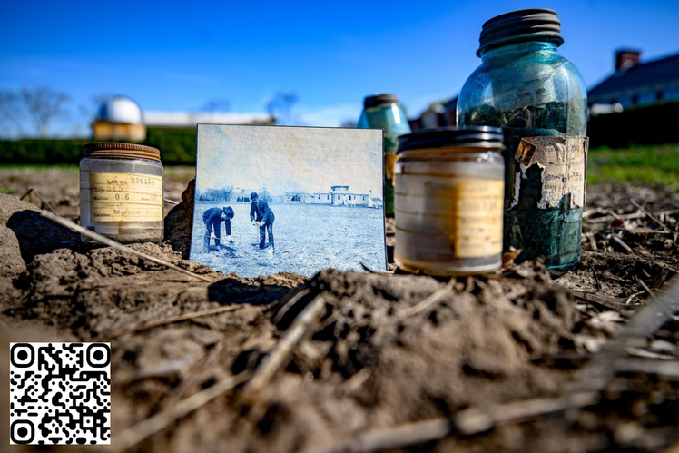
The project started when soil scientist Andrew Margenot stumbled upon a trove of ancient soil samples — some dating back to the late 1800s — in a university barn slated for demolition. Likely the oldest and largest soil archive in the world, the 8,000-sample collection was ripe for analysis.
After finalizing the digitization of the soil archive a year ago, Margenot, with funding support from the Illinois Nutrient Research and Education Council (NREC) and Illinois Farm Bureau, implored current landowners to let his team re-sample the 453 original locations. So far, the U. of I. team has only been able to access 8% of the sites.
“It's one thing to figure out who owns the piece of land; that’s public information. What we need is a way to get in touch with folks and, of course, their permission to re-sample,” said Margenot, an associate professor in the Department of Crop Sciences and Illinois Extension, both part of the College of Agricultural, Consumer and Environmental Sciences (ACES) at U. of I.
Comparing the historic soils with new samples will provide unparalleled insights into the state’s soil resource base, including the effects of climate change, erosion, and sustainable practices. Margenot says the data could benefit farmers, engineers, and municipal planners.
“Our sampling would have a negligible impact: a 1.5-inch diameter probe would be used to sample soils 3 feet deep at three points within a 10- to 15-foot area,” Margenot said. “The location would be anonymized (county-level) to protect the privacy of the specific sampling location.”
In exchange for allowing researchers to take samples, landowners have full access to their results, a $5,000 value. Additionally, Margenot’s research team would be available to discuss and interpret the results with landowners, an invaluable perk for many.
Illinois property owners should check the soil archive map, click on the pins, and navigate to the individual sign-up link connected to each location. For more information, landowners can contact the researchers directly at margenot@illinois.edu or suweixu2@illinois.edu.